EAST CENTRAL — Five east central communities will receive funding for community flood mapping.
Tisdale, Melfort, Arborfield, Cudworth and Watson have been designated “high risk” for future flooding.
Sam Ferris, vice president of the regulatory division for the Water Security Agency, said each high risk community was chosen due to site specifics.
“We based our evaluation looking at historical problems associated with flooding in these communities,” Ferris said. “It also depends on the proximity of the community to a water course or a water body like a creek, lake, river or slough.”
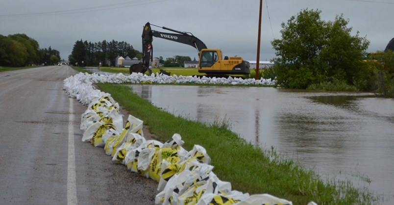
Flood mapping identifies areas that are at-risk for flooding from nearby rivers, lakes and streams, including those impacted by anticipated developments or changes in climate.
Ferris said that the decision to do the mapping was largely inspired by the spring of 2011 and 2013, which had a significant amount of flood damage associated with spring runoff.
“And then in the south east portion of the province we had very significant rain in the July long weekend of 2014,” he said. “That sort of emphasized the need to look at food mitigation measures, the first of which would be flood mapping and modeling of flows in food prone areas.”
Dustin Duncan, minister responsible for the Saskatchewan Water Security Agency (WSA), stated in a press release that flood mapping is vital for communities to manage potential flood hazards, and to implement effective mitigation measures.
“This partnership is a positive step toward helping communities become more resilient in the face of climate change – a priority in Saskatchewan’s Prairie Resilience climate change strategy,” Duncan said.
Ferris said dealing with flooding is one element of that plan.
“We should expect, overall, more precipitation on an annual basis and warmer, wetter winters. Potentially during summertime, more significant storms,” Ferris said “The idea here is to prepare communities for the impacts of flooding.”
The WSA will proceed with flood mapping for 20 high-risk communities through the National Disaster Mitigation Program on a 50-50 cost share basis between the province and federal government. The total cost of the project is $1 million.
The full list of high risk communities includes Melfort, Moose Jaw, Regina, Saskatoon, Weyburn, Yorkton, Arborfield, Cudworth, Eastend, Foam Lake, La Ronge, Lashburn, Maple Creek, Tisdale, Wadena, Watson, Wolseley, Air Ronge, Borden and Gainsborough.
There is no cost to the communities who have been identified as high risk.
Duncan said the Ministry’s goal is for the Water Security Agency to have 100 per cent of food mapping done for all at risk communities at risk communities by 2030.
The funding was announced on Aug. 12.


